Tuzigoot National Monument
Arizona
Tonight
🌔 74% moon
9 h fully dark
Crowds
low
Open today
Open
Tuzigoot National Monument: closed Nov 26 – Nov 26; Tuzigoot National Monument: closed Dec 25 – Dec 25; Tuzigoot National Monument: closed Jan 1 – Jan 1
Entrance
$10
Stage 1 Fire Restrictions
Stage 1 Fire Restrictions begin May 21st. Igniting or using fires fueled by combustible materials, that create an open flame, is strictly prohibited. Smoking is only allowed within an enclosed vehicle or developed site. For details on fire restrictions, visit https://wildlandfire.az.gov/fire-restrictions
Official NPS alert →Park Unable to Receive Phone Messages
At this time, phone messages cannot be left at the visitor center. Please email the park at moca_tuzi_info@nps.gov or call during operating hours if you need to contact the park.
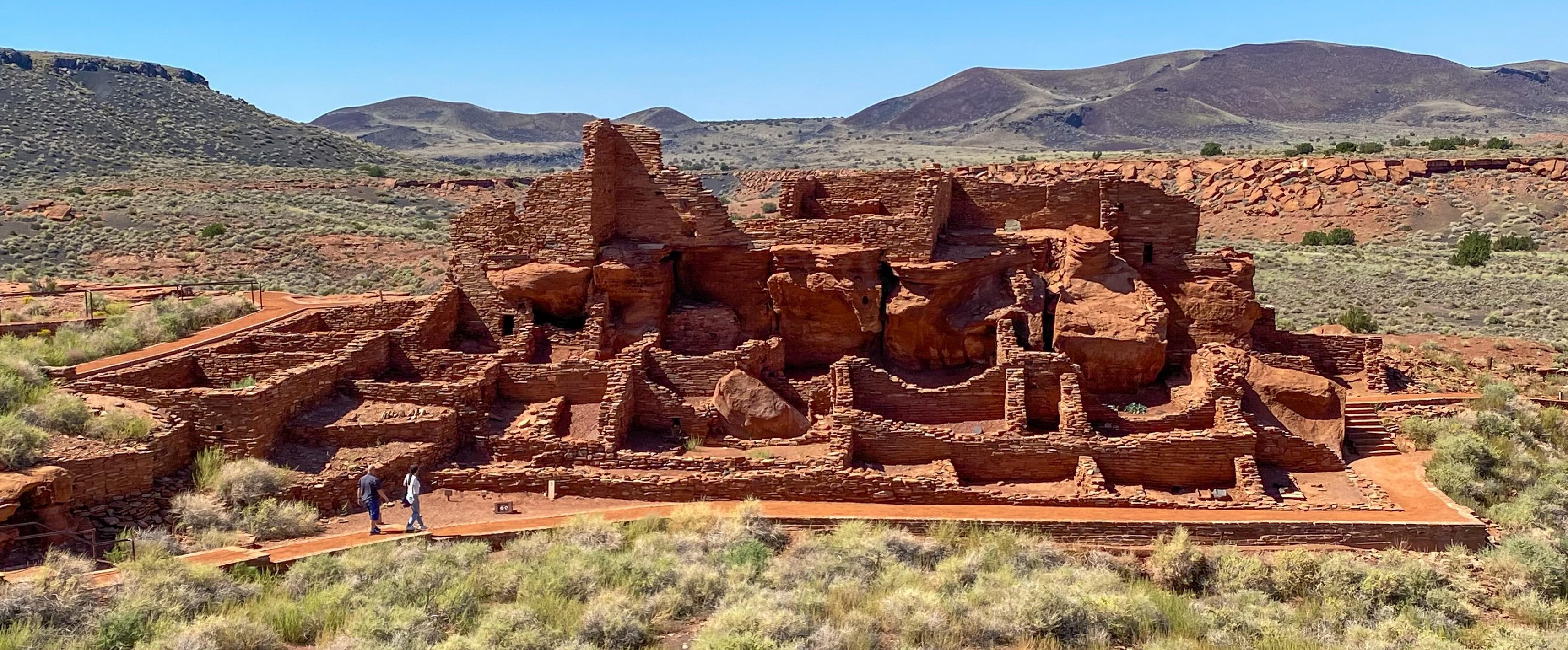
Official NPS alert →Water flows under and through this landscape, feeding the growth of people and towns. The Verde Valley is watered by snowmelt, summer monsoons, and springs that well up from the ancient sedimentary rocks. In the heart of the valley, a thousand years ago, people began to build a little hilltop pueblo that would grow into one of the largest villages in the area.
Activities
Topics
Entrance fees
$10.00 — Entrance - Per Person
Hours & seasons
Tuzigoot National Monument is open every day with the exception of Thanksgiving Day, December 25, and January 1. During regular operating hours, last vehicle entry is at 4:45 pm.
⚠ Tuzigoot National Monument: closed Nov 26 – Nov 26; Tuzigoot National Monument: closed Dec 25 – Dec 25; Tuzigoot National Monument: closed Jan 1 – Jan 1
Generally open:
winterspringsummerfallHours are reported by the park — verify before you go.
📞 928-634-5564
✉ moca_tuzi_info@nps.govConditions
Quietest months (fewer crowds): Jul, Aug
Typical crowds: low
Weather now: ⛅ Partly cloudy, 73°F
☁️ 91°/60°
☁️ 91°/69°
☁️ 88°/67°
Typical monthly recreation visits · NPS avg 2023–2025 — orange months are the quietest by crowds.
Quietest months
Relative crowds by month — lighter is quieter; ringed months are the calmest by crowds.
Jan
41%
Feb
62%
Mar
100%
Apr
85%
May
69%
Jun
45%
Jul
34%
Aug
32%
Sep
51%
Oct
45%
Nov
52%
Dec
51%
Log a sky reading
Measured the sky with an SQM meter or app? Add your reading (16 = city glow … 22 = pristine). Opt in under “Travelers like you” to share it on the community leaderboard.
Things to do
Visit Tuzigoot Pueblo · 0.3 mi
Become a Montezuma Castle and Tuzigoot BARK Ranger · Completing the BARK ranger card and purchasing the tag only takes a few minutes, but hikes in the parks can take up to two hours or more. The Pueblo Trail at Tuzigoot, Pasture and Well Trails at Montezuma Well, and loop trail at Montezuma Castle all take approximately 30-40 minutes each to hike.
Visitor centers
Tuzigoot Visitor Center
Accessibility
Reported by the park — verify before you go.
Not an official safety source — always defer to NPS.gov and rangers for life-safety decisions.
By the numbers
A visual read on Tuzigoot National Monument — its character, trails, sky, and weather.
Park fingerprint
How this park scores across the dimensions travelers care about.
Trail difficulty
Difficulty mix across this park's trails.
3-day forecast
Daily high and low temperatures (°F).
People & stories
Figures tied to Tuzigoot National Monument — each spans a cross-park journey.
Grace Sparkes
— Women's History, Women Of The NPS, Historic Women Of The NPSLouis Caywood
— Archeologist, Archaeologist, History Of ArcheologyPassport stamps
Mark the stamps you've collected — they show in your memory and along your routes.
🎫 Tuzigoot Visitor Center
Audio & media
🎧
🎬
🖼
Learn more
In spring 2011, the SCPN-NAU School of Communication collaboration began with a multimedia studies course focused on documenting park resources and resource projects. The class was taught by NAU professors Laura Camden and Peter Friederici.
When the climate changes enough, the vegetation communities growing in any given place will also change. Under an expanded bimodal climate zone, some plant communities in western national parks are more likely to change than others. National Park Service ecologists and partners investigated the future conditions that may force some of this change. Having this information can help park managers decide whether to resist, direct, or accept the change.
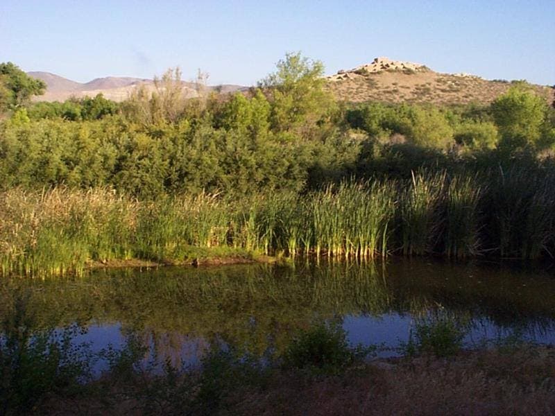
In the Verde Valley of Arizona, Tuzigoot National Monument features a Southern Sinagua pueblo and the Tavasci Marsh, a natural area along the Verde River. While the valley was more recently the site of several large copper mines, it has a deep history that goes back thousands of years. This history is just as connected to the natural resources of the Verde Valley as the mining operations of the 19th and 20th centuries.
Across the US, changes in water availability are altering which plants grow where. These changes are evident at a broad scale. But not all areas experience the same climate in the same way, even within the boundaries of a single national park. A new dataset gives park managers a valuable tool for understanding why vegetation has changed and how it might change in the future under different climate-change scenarios.
Climate is the primary driver of ecological processes on Earth. Sonoran Desert Network scientists monitor climate and how it may be changing at Tuzigoot National Monument to better assess the condition of park resources. A weather station in the park has been in operation since 1991. This report summarizes Water Year 2024 climate data.
Climate is one of many ecological indicators monitored by the National Park Service (NPS) Division of Inventory & Monitoring (I&M). Climate data help scientists to understand ecosystem processes and help to explain many of the patterns and trends observed in other natural-resource monitoring. In NPS units of the American Southwest, three I&M networks monitor climate using the scientific protocol described here.
At Montezuma Castle and Tuzigoot national monuments, the precontact built environment reflects the importance of reliable water sources. At these parks, the Sonoran Desert Network monitors the health of Beaver Creek, Wet Beaver Creek, and the Verde River. The program is designed to detect broad-scale changes in ecological condition by observing certain parameters over time—and to give park managers early warning of any issues they may need to address.
At Montezuma Castle and Tuzigoot national monuments, the precontact built environment reflects the importance of reliable water sources. At these parks, the Sonoran Desert Network monitors climate, groundwater, springs, and streams. Understanding changes in these closely linked factors helps managers make informed decisions affecting both natural and cultural resources. Learn about our recent findings in these special parks.
Ranger School
Park-grounded courses you can learn with the Ranger.
How Tuzigoot National Monument connects
This park's activities, topics, location, and on-the-ground places — one hop in the graph. Drag to explore; click an activity, topic, or related park to follow it.
Park
Activity
Topic
State
VisitorCenter
PassportStamp
Trail
ThingToDo
Alert
Similar parks
Share activities & topics with Tuzigoot National Monument.