Fort Davis National Historic Site
Texas
Tonight
🌓 65% moon
9.1 h fully dark
Crowds
low
Open today
Open
Regular Hours: closed Nov 26 – Nov 26; Regular Hours: closed Dec 25 – Dec 25; Regular Hours: closed Jan 1 – Jan 1; Regular Hours: closed Jan 18 – Jan 18
Entrance
$10
Fort Davis NHS is a NO DRONE Zone!
The use of drones is prohibited at Fort Davis National Historic Site. Thank you for preserving the cultural landscape.
Official NPS alert →Fort Davis NHS is in the Central Time Zone
Fort Davis National Historic Site is located in the Central Time Zone. The park is open 8:00 am until 5:00 pm (Central Time). The Visitor Center closes at 4:30pm. The Main Gate locks at 5:00pm.
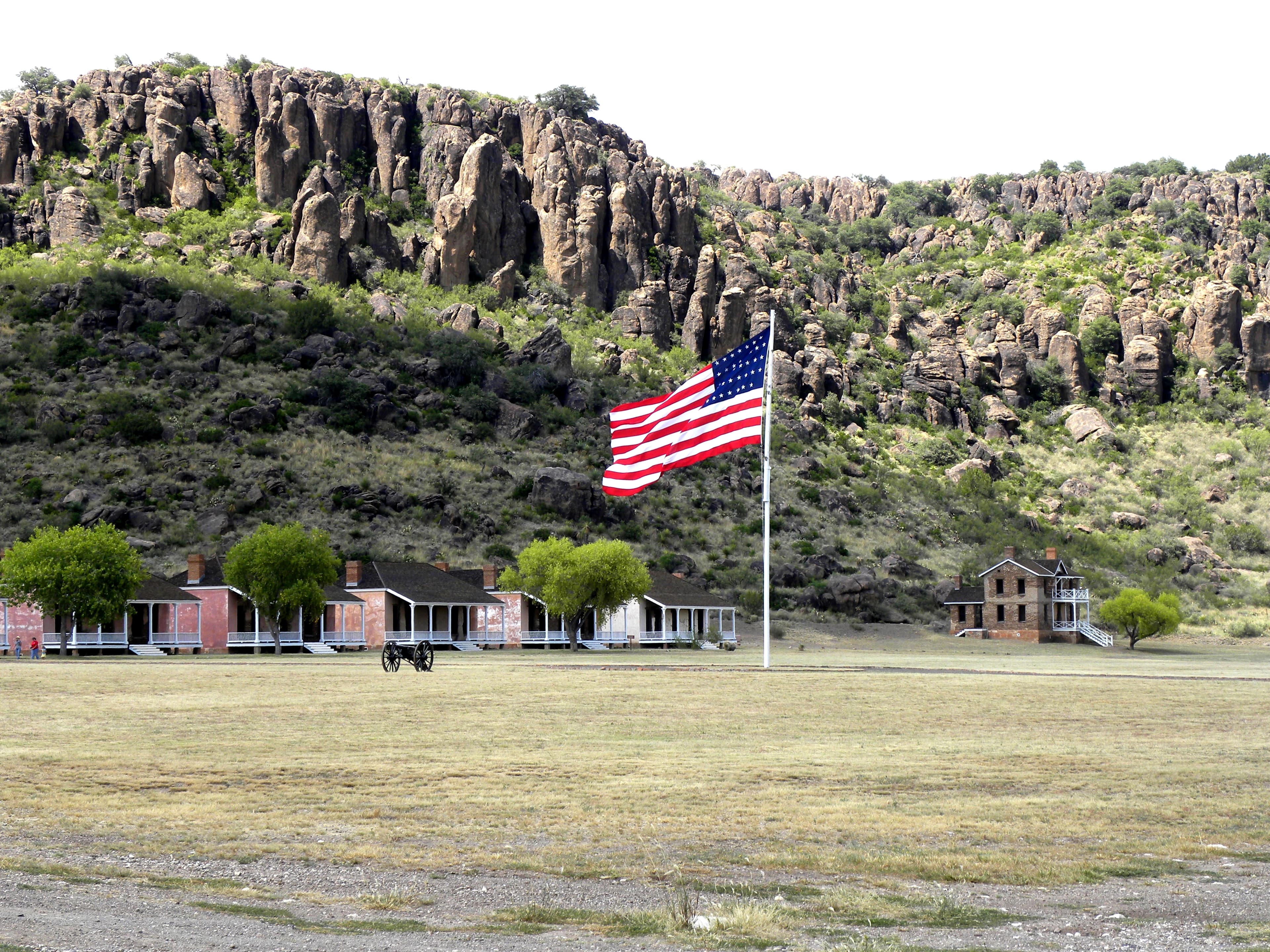
Fort Davis is one of the best surviving examples of an Indian Wars' frontier military post in the Southwest. From 1854 to 1891, Fort Davis was strategically located to protect emigrants, mail coaches, and freight wagons on the Trans-Pecos portion of the San Antonio-El Paso Road and on the Chihuahua Trail.
Activities
Topics
Entrance fees
$10.00 — Entrance - Per Person
$15.00 — Entrance - Motorcycle
$20.00 — Entrance - Private Vehicle
$20.00 — Commercial Entrance - Sedan
$40.00 — Commercial Entrance - Van
$40.00 — Commercial Entrance - Mini-bus
$100.00 — Commercial Entrance - Motor Coach
Hours & seasons
Daily Hours are 8:00 AM - 5:00 PM Holiday Closures: Thanksgiving Day, Christmas Day, New Year's Day, and Martin Luther King Jr. Holiday.
⚠ Regular Hours: closed Nov 26 – Nov 26; Regular Hours: closed Dec 25 – Dec 25; Regular Hours: closed Jan 1 – Jan 1; Regular Hours: closed Jan 18 – Jan 18
Generally open:
winterspringsummerfallHours are reported by the park — verify before you go.
📞 1-432-426-3224
✉ FODA_Superintendent@nps.govConditions
Quietest months (fewer crowds): Jan, Aug, Sep
Typical crowds: low
Weather now: 🌦️ Drizzle, 80°F
🌦️ 86°/61°
🌦️ 87°/64°
☁️ 79°/60°
Typical monthly recreation visits · NPS avg 2023–2025 — orange months are the quietest by crowds.
Quietest months
Relative crowds by month — lighter is quieter; ringed months are the calmest by crowds.
Jan
29%
Feb
35%
Mar
100%
Apr
59%
May
41%
Jun
35%
Jul
40%
Aug
27%
Sep
23%
Oct
34%
Nov
45%
Dec
37%
Log a sky reading
Measured the sky with an SQM meter or app? Add your reading (16 = city glow … 22 = pristine). Opt in under “Travelers like you” to share it on the community leaderboard.
Visitor centers
Visitor Center
Accessibility
Reported by the park — verify before you go.
Parking
Parking Lot · 2 accessible spacesaccessible
Not an official safety source — always defer to NPS.gov and rangers for life-safety decisions.
By the numbers
A visual read on Fort Davis National Historic Site — its character, trails, sky, and weather.
Park fingerprint
How this park scores across the dimensions travelers care about.
3-day forecast
Daily high and low temperatures (°F).
People & stories
Figures tied to Fort Davis National Historic Site — each spans a cross-park journey.
Gabriel Turner
— Reconstruction, Reconstruction Era, Reconstruction Era National Historical ParkPollard Cole
— Buffalo Soldier, Usct, VeteranPassport stamps
Mark the stamps you've collected — they show in your memory and along your routes.
🎫 Visitor Center
Audio & media
Learn more
Co. A of the 10th U.S. Cavalry was stationed at Fort Larned from April 1867 to January 1869. Although they served with dedication, their time at the fort was troubled by racial prejudice.
When the climate changes enough, the vegetation communities growing in any given place will also change. Under an expanded bimodal climate zone, some plant communities in western national parks are more likely to change than others. National Park Service ecologists and partners investigated the future conditions that may force some of this change. Having this information can help park managers decide whether to resist, direct, or accept the change.
Following the Civil War, permanent African American regiments were constructed in the United States Army. Although segregated due to race, these regiments served with honor and distinction, and helped to tame the Wild West.
Three park units in the Chihuahuan Desert Network, Big Bend National Park (NP), Carlsbad Caverns NP, and Guadalupe Mountains NP are designated as Class I air quality areas under the Clean Air Act. Class I areas receive the highest protection under the act, and degradation of air quality must be minimal. Air quality concerns include atmospheric deposition effects and visibility impairment from fine particle haze.
The Chihuahuan Desert Network is currently developing protocols to monitor several vital signs that may reflect current and future impacts of climate change. This brief offers a summary of how Chihuahuan Desert Network monitoring will detect future change.
Climate is one of many ecological indicators monitored by the National Park Service (NPS) Division of Inventory & Monitoring (I&M). Climate data help scientists to understand ecosystem processes and help to explain many of the patterns and trends observed in other natural-resource monitoring. In NPS units of the American Southwest, three I&M networks monitor climate using the scientific protocol described here.
Climate and hydrology are major drivers of ecosystem structure and function, particularly in arid and semi-arid ecosystems. The Chihuahuan Desert Inventory and Monitoring Network monitors climate at Fort Davis National Historic Site and groundwater wells near the park. Understanding climate and water resources is an important part of assessing the condition of park biota and cultural resources.
Climate and hydrology are major drivers of ecosystem structure and function, particularly in arid and semi-arid ecosystems. The Chihuahuan Desert Inventory and Monitoring Network monitors climate at Fort Davis National Historic Site and groundwater wells near the park. Understanding climate and water resources is an important part of assessing the condition of park biota and cultural resources.
How Fort Davis National Historic Site connects
This park's activities, topics, location, and on-the-ground places — one hop in the graph. Drag to explore; click an activity, topic, or related park to follow it.
Park
Activity
Topic
State
VisitorCenter
PassportStamp
ParkingLot
Trail
Alert
Similar parks
Share activities & topics with Fort Davis National Historic Site.